")
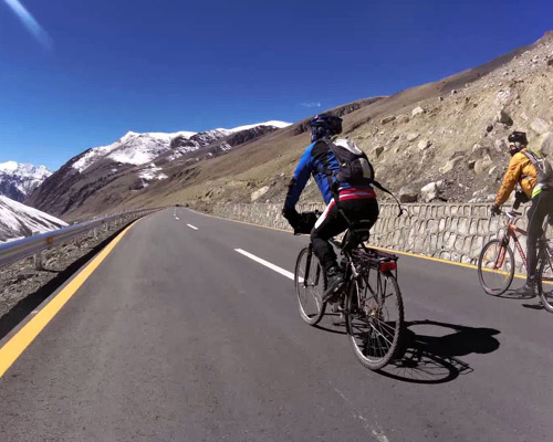
Khunjrab Pass
Khunjrab pass name is derived from Wakhi 'Khun' means Home and 'Jerav' means spring water/water falling at an elevation of 4690 is a high mountain pass in the Karakoram Mountains in strategic position on the northern border of Pakistan's Gilgit–Baltistan on the southwest border of the Xinjiang region of China.
On the Pakistani side, the pass is 42 km (26 mi) from the National Park station and checkpoint in Dih, 75 km (47 mi) from the customs and immigration post in Sost, 270 km (170 mi) from Gilgit, and 870 km (540 mi) from Islamabad. The long, relatively flat pass is often snow-covered during the winter season and closed from November 30 to May 1.
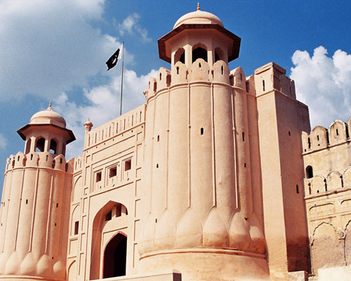
Lahore
Lahore the capital city Punjab and the second largest metropolitan area in the country. With a rich history dating back over a millennium One of the most thickly populated cities in the world, Lahore remains an economic, political, transportation, entertainment, and educational hub. It is referred to as the "Mughal City of Gardens" due to the historic presence of gardens in and around the city dating back to the Mughal period.
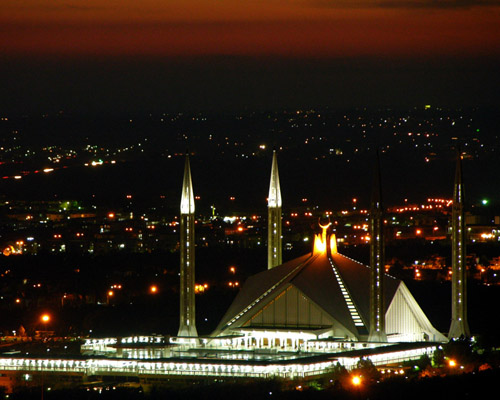
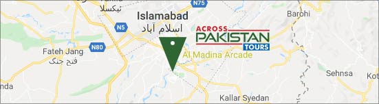
Islamabad
Islamabad capital of Pakistan is a young, vibrant, modern and beautiful city. The true face of the progressive Pakistan, Islamabad is a city to get lost. Its wide streets, beautiful houses and colorful bazaars present a picturesque face of Islamabad. The power center of Pakistan, Islamabad is the capital of the country.
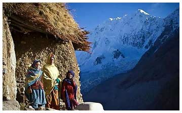
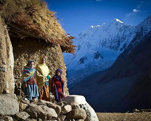
Shimshal
Surrounded by innumerable, fascinating and awe-inspiring peaks, glaciers, alpine meadows and trekking routs, the last and magnificent village of Gilgit-Baltistan region, about 3000 meters above see level is SHIMSHAL, which is at 50 km distance-three hours Jeep drive from KKH Passu. Living at this remotest place in Pakistan, the sons of the land are matchless in-terms of mountaineering prowess and techniques who have made a remarkable contribution in the mountaineering history of Pakistan. Shimshali guides and high altitude climbers are internationally recognized for their professionalism and bravery.
Broghil
Broghol, also spelled Broghil, Boroghil and several other ways elevation (3798 m), is a high mountain pass along the Durand Line border that crosses the Hindu Kush mountain range and connects Wakhan of Badakhshan Province, Afghanistan with Chitral of Khyber Pakhtunkhwa, Pakistan.
It is one of the four major mountain passes entering Chitral; the others are the Dorah Pass from Badakshan Province of Afghanistan, Shandur Top from Gilgit, and Lowari Top from Upper Dir District.
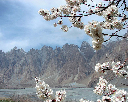
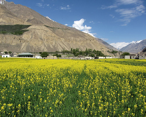
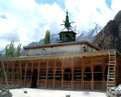
Upper Hunza
Upper Hunza is comprises of Gojal Valley ,is Fairy tale valley famous for high peaks Captivating Glaciers Beautiful meadows, breathtaking pastures the valley harbors a diverse and endangered mountainous cultural traditions, is spread over an area of about 8,500 sq.km at an elevation ranges from 2,340m to 4,877m.
The valley borders internationally with the Xinjiang-Uighur region of People Republic of China through the famous Khunjrab, Kilik and Mintika passes and with the Afghan Wakhan The main towns, villages and valleys are of upper Hunza : Gulmit Passu, Sost Shimshal Chipursan Khudaabad Khunjareb Pass Khyber Morkhoon Migar Misgar Raminj.
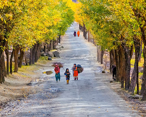
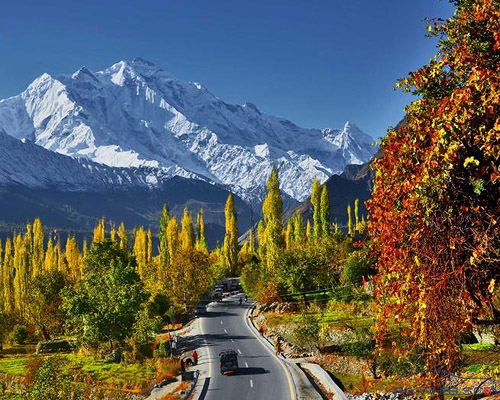
Hunza
The Hunza mountainous valley in the Gilgit–Baltistan region of Pakistan. is situated north/west of the Hunza River, at an elevation of around 2,500 metres at distance of 710 km from Islamabad Surrounded by mountains like Ultar Sar, Rakaposhi, Bojahagur Duanasir II, Ghenta Peak, Hunza Peak, Passu Peak, Diran Peak and Bublimotin (Ladyfinger Peak), all 6,000 metres or higher.
Hunza is a popular tourist destination because of the spectacular scenery Aliabad is the main town while Baltit The former capital an elevation of 2477 meters an earlier fort and Altit Fort, have been extensively restored and attractions in the region is a popular tourist destination because of the engrossed scenery of the surrounding.
Gilgit
Gilgit, the capital of Pakistan Northern area is a flourishing Frontier Town that is expanding swiftly guarded by Peak Domani 6134m and fragment of the Rakaposhi Range and 4500m barren peaks from 3 sides a wide irrigated bowl 1500 m above the sea level covers an area of 72,971 km².
The Gilgit manuscripts are among the oldest manuscripts in the world was discovered in 1931 and the oldest manuscript collection surviving in Pakistan having major significance in the areas of Buddhist studies and the evolution of Asian andSanskrit literature. The manuscripts are believed to have been written in the 5th to 6th centuries AD, though some more manuscripts were discovered in the succeeding centuries, which were also classified as Gilgit manuscripts and in 2006 to be included on the UNESCO Memory of the World register.
Shigar
The Shigar Valley, 32kms (20 miles) from Skardu and 40 minutes by jeep, is watered by the Shigar River, falls in Pakistan's Northern Areas. The secluded Shigar Valley is. Amidst the strikingly beautiful and majestic mountains, slowly merging into an oasis of green fields, Shigar is situated on the banks of the Indus, at a height of 2798 meters.
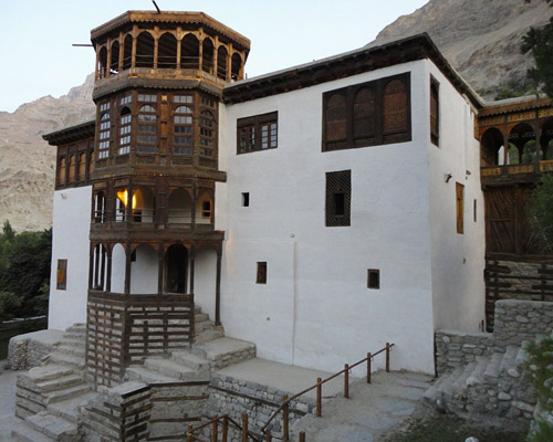
Khaplu
Home and 'Jerav' means spring water/water falling at an elevation of 4690 is a high mountain pass in the Karakoram Mountains in strategic position on the northern border of Pakistan's Gilgit–Baltistan on the southwest border of the Xinjiang region of China.
On the Pakistani side, the pass is 42 km (26 mi) from the National Park station and checkpoint in Dih, 75 km (47 mi) from the customs and immigration post in Sost, 270 km (170 mi) from Gilgit, and 870 km (540 mi) from Islamabad. The long, relatively flat pass is often snow-covered during the winter season and closed from November 30 to May 1
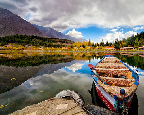
Skardu
Skardu star stone, meteorite an altitude of nearly 2,500 m is a town and capital of Skardu District, in Gilgit–Baltistan,Pakistan. Skardu is in the 10 kilometres wide by 40 kilometers long Skardu Valley, at the confluence of the Indus flowing from Near Kailash in Tibet and through Neighbouring Ladakh already travelled 700 km before reaching Baltistan and the River.
Under the Shadow of Kharphocho Fort on a design similar to that of Leh palace and the Potatla Palace in Lhasa ,Tibet dates from the 8th century CE and contains an old mosque probably dating back to the arrival of Islam in the 16th century CE with a myth it was built by a ghost as they were servants of the ruler of that time, on the northern Bank the main block of the Karakoram mountains rises in a serried wall, 150 km thick with almost 100 peaks rising to over 7,000 .in no other part of the world is there such a large numbers of high mountains in such a curbed place is fascinating den for the travelers.
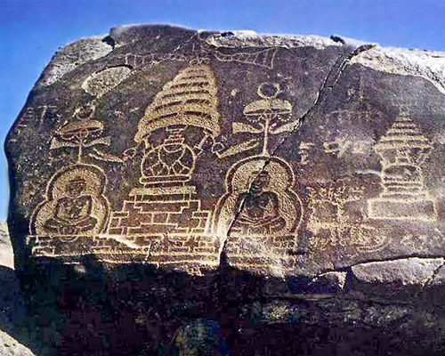
Chilas
Chilas a small town located in the Gilgit-Baltistan, Pakistan on the left side of river Indus. It is part of the Silk Road connected by the Karakoram Highway which links it to Islamabad in the south via Dassu, Besham, Mansehra, Abbottabad and Haripur. In the north, Chilas is connected to the Chinese cities of Kashgar and Tashkurgan via Gilgit, Sustand the Khunjerab pass.
There are more than 50,000 pieces of rock art (petroglyphs) and inscriptions all along the Karakoram Highway in Gilgit-Baltistan of Pakistan and chilas is one such site ,and hundreds of petroglyphs can be found the INDUS below the city.
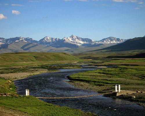
Deosai
Covering an area of 3,000 square kilometers, at an altitude of 4000 m above sea level, between the western massif of the Himalayas and the central Karakoram lies Deosai plateau the home of Brown bear Deosai plateau is uniquely beautiful region, which is the highest plains in the world and is situated 32 Km south of Skardu, the head quarter of Baltistan.It can be approached from two sides - Skardu and Gilgit-Astore. From Skardu (2340 meter) to Sadpara lake to Sadpara village, Ali Malik Mar (4080Meter) Which marks the start of Deosai, to cross the hanging bridge on Bara pani overlooking Burji pass to Sheausar lake the beautiful and highest lake to Chilam chauki (in whose south is the Chakor pass 4266 meters and Burzil pass 4280 meters and then boundary of Indian occupied Kashmir and on to Srinagar) From Chilum to Das Khirim to khume Gah- Gudai and the to Astore which is 115 KM from Gilgit.
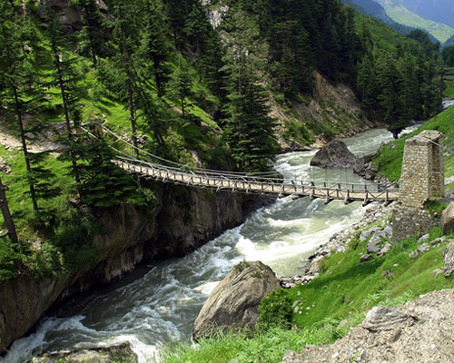
Kaghan
155 km long 'the botanist’s paradise ‘The Kaghan Valley is located in Northern Pakistan northeast of Hazara, NWFP. It's one of the valleys that's relatively easy to reach from Rawalpindi / Islamabad. Rising from an elevation of 2,134 meters to its highest point, the Babusar Pass, at 4,145 meters, mountain scenery, the dales, lakes, water-falls, streams and glaciers make the valley a most visited tourist destination in Pakistan.
Pristine fairy tale lakes, dense forests of pine, lofty peaks roaring Kunhar River full of trout fish make you engrossed while passing through the Shogran, Naran Gitdas, and babusar Pass.
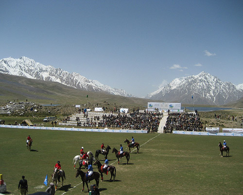
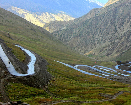
Shandur Pass
The world famous Shandur pass is about 3738 meter an above sea level and lies midway between Chitral and Gilgit in good old days it was regarded as being “half-way to Heaven”. The distance from Chitral is 147 Km and Gilgit is about 211Km.
These areas remains snow covered in winter and turn into the green heaven during summer season. There is a big lake in the area. The traditional polo tournament played between Chitral and Gilgit teams in the month of hot July.
Chitral
Chitral Valley 322 km long most quixotic, fascinating and delightful and exotic valley in the majestic Hindukush range and dominated 7,788 meters Trichmir by . At an elevation of 1128 meters surrounded by the Wakhan, Badkhshan, Asmar and Nooristan area of Afghanistan in the north, west and south-west. On its southern boundary lies Dir. In the east lies Gilgit agency and Swāt Kohistan. The narrow strip of Afghan territory, Wakhan, separates it from Tajikistan. The landscape of Chitral is extremely mysterious, with its steep harsh mountains, lush green valleys, beautiful meadows and big glaciers.
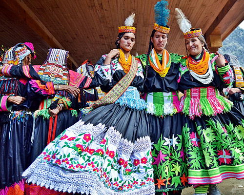
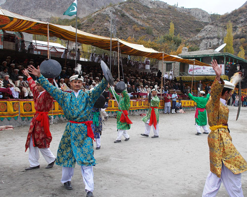
Kalash Valley
The 3,000 strong Kafir-Kalash live in the valley of Birir, Bumburet and Rambur in the South. Bamburet, the largest and the most picturesque valley of the Kafir-Kalash, is 40km from Chitral and is connected by a jeep able road. Birir, 34km away is accessible by a jeep able road. Rumbur is 32km from Chitral. Their picturesque headgear is made of woolen black material decked out with cowry shells, buttons.
The Kalash people love music and dancing particularly on occasions of their religious festivals like Joshi Chilimjusht (14th & 15th May - spring), Phool (20th - 25th September) and Chowas (18th to 21st December).
Swat
With the roaring Rivers ,cascading water falls snow covered peaks, fruit laden orchards ‘Udyana’ the garden, in ancient Hindu epics and Now Mini Switzerland of Pakistan SWAT.
247km from Islamabad covering an area of 5337sq km 3250feet above sea level an idyllic tourist destination After the invasion of Alexander the great the famous Gandhara Buddhist civilization later flourished in this valley.
The remains of the Buddhist Stupas, monasteries and settlements can still be found in at various places of this region.
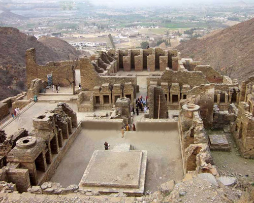
Takht Bhai
Takht Bhai, literally meaning "spring or well on a high surface". The spring of that period still exist on western hill and is used by the local people. Therefore the Buddhist sanctuary and the nearby village were named after these wells. The remains are most astounding, exciting and imposing relics of Buddhist in Pakistan. Dated back from 2nd BC to 5th century AD and scattered over 32.9 hectares. The site was excavated by Dr D.B Spooner and Mr. Hargreaves in 1907-09 and 1910-11 respectively. The remains consist of main stupa, votive stupas, court, lofty chapels, monastic quadrangle, meditation cells, covered passages and many other secular buildings. All are stone built laid in lime and mud mortar in diaper style masonry. A large number of stone and stucco sculptures have been unearthed during excavation, which now on display in Peshawar museum. The sculpture depicts the life of Buddha before his birth and different events of his life and reveals evolutionary and developmental stages of Gandhara art.
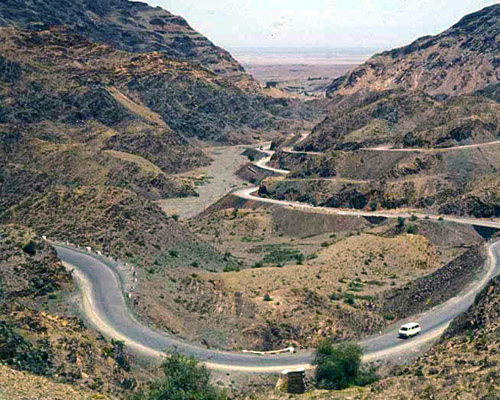
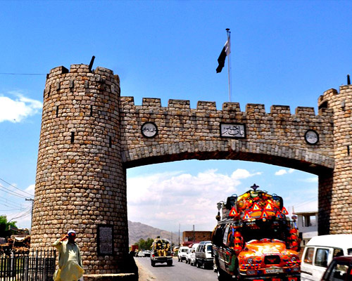
Khyber Pass
56 kilometer from the Peshawar lies 44 km long Khyber pass which winding through the safed koh mountain bordering with Afghanistan Due to his geographical and historical importance elevates him from other passes of Pakistan Starting at an elevation of 491 at Jamrud and and end at an elevation of 1070 at Torkham.
For Centuries the trade route and invasion route Khayber passes witness the Armies of Alexander the Great, Timur, Babur, Mahmud of Ghazna, and Nadir Shah in their invasions of India.
In 1920 in the Birtish regime a rail road was constructed passing 34 tunnels and 92 bridges and culverts.
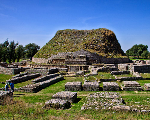
Taxila
Taxila is situated on the Pivotal junction of India,wester asia and centerial asia ,40 Km from Captial City of Pakistan Islamabd lies this town and famous Archaeogical site.
Ancient Taks.as illa means “City of Cutting Stones” or Rocks of Takasha.
Some of the most important sites are; Dhamarajika Stupa and Monastery (300 BC - 200 AD), Bhir Mound (600-200 BC), Sirkap (200 BC - 600 AD), Jandial Temple (c.250 BC) and Jaulian Monastery (200 - 600 AD). IN 1980 Taxila was declared a UNESCO world heritage site.
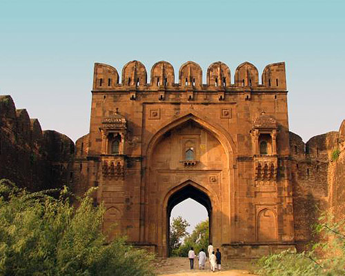
Rohtas Fort
Rohtas Fort is a historical garrison fort located near the city of Jhelum in Punjab, Pakistan. built by Raja Todar Mal, under the instructions of the Sher Shah Suri an Afghan king , to reduce the rebellious tribes of the northern Punjab region, in the 16th century. The fort was built in the Afghan-Persian architectural style and is about 4 km in circumference took eight years to construct on a hillock where the tiny Kahan river meets another rainy stream called Parnal Khas and turns east towards Tilla Jogian Range. The fort is about 300 feet (91 m) above its surroundings. It is 2660 feet (818 m) above sea level and covers an area of 12.63 acres and lies the on the historic Grand Trunk Road between the mountainous region of Khyber Pakhtunkhwa and the plains of Punjab. 16 km NW of Jhelum and 7 km from Dina.
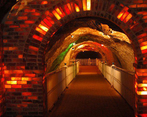
Salt Range
Its series of hills and low mountains between the valleys of the Indus and Jhelum rivers, located in the northern part of the Punjab region of Pakistan. It derives its name from extensive deposits of rock salt that form one of the richest salt fields in the world; they are of Precambrian age and range up to more than 1,600 feet (490m) in thickness.
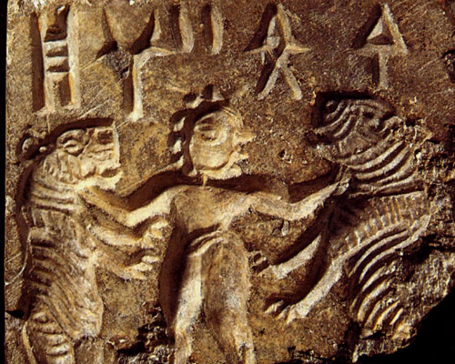
Harappa
Harappa is located in the Punjab Province of Pakistan and the site lies some 35 kilometers southwest of Sahiwal. Harappa is the first site of the Indus Valley Civilization that was discovered in the 1920s. Harappa is located about 250 kilometers from Lahore. Excavations in Harappa have revealed a egalitarian civilization, which was excellent in town planning and other sphere of everyday life. The site, with its citadel and great granary, seems similar in many ways to Mohenjo-Daro and like its southern sister-city appear to have thrived around 2000 to 1700 B.C. with an economy based largely on agriculture and trade.
A tour to Harappa takes you close to one of the largest civilizations in the world and help you understand how modern and progressive was the Indus Valley Civilization and why This civilization received kudos from the historians and archaeologists.
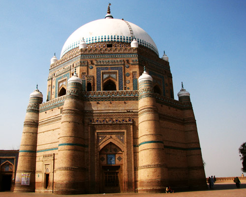
Multan
Multan It is Pakistan's fifth largest city by population and has an area of 133 square kilometers The city is located on the banks of the Chenab Riverin the geographic center of the country a rich and well-defended city for more than 2000years and famous for its 13th and 14th Century bricks shrines decorated with with blue glazed tiles.
Multan is known as the City of Sufis or City of Saints and Madinat-ul-Auliya because of the large number of shrines and Sufi saints from the city. The city is blanketed with bazaars, mosques, shrines, and ornate tombs.
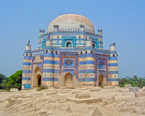
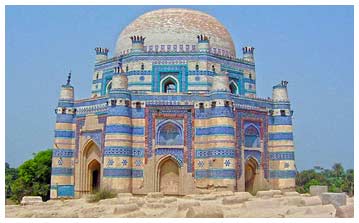
Uchi Sharif
Uchi Sharif is situated at 73 km from Bahawalpur city in southern Punjab literally meaning Holy High Place and is famous for sufi Shrines that is why it is also known as City of Saints.
The most exquisite ruins ,most aesthetically pleasing in the blue and white tiles Tomb of BIBI jawindi build in 1498.
Uch near the confluence of the chanabd and Sutlej rivers was famous long before the advernt of Islam. Alexander the Great arrived in 325 BC
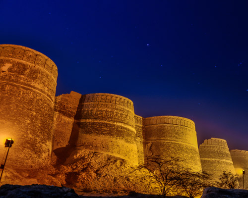
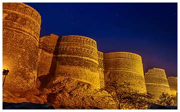
Cholistan Desert
The word Cholistan is derivative from the Turkish word chol, which means "desert".
Cholistan thus means Land of the Desert and locally know as Rohi sprawls thirty kilometers from Bahawalpur and covers an area of 26,300 square kilometres It link up with the Thar Desert, extending over to Sindh and into India. The history of Cholistan starts from the history of Indus Valley civilization, which prospered from about 2500 BC to 1500 BC around the Indus River.a
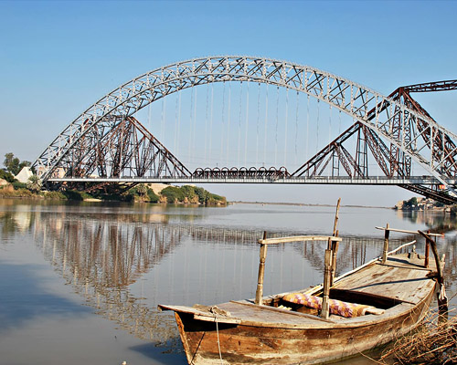
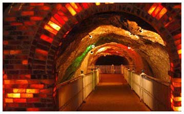
Sukkur
Sukkur the home on Lloyd Barrage now called as Sukkur Barrage has 66 Gates. The barrage Was designed by Sir Arnold Musto KCIE and constructed under the supervision of Sir Charlton Harrison KCIE from 1923-1932. 1524 m long barrage was made of yellow stone and steel and can water 10 million acres of farmland through its seven large canals controls one of the largest irrigation systems in the and some of the canals are larger than Suez canal.
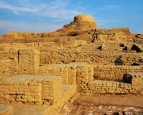
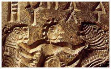
Mohenjo-daro
Mohenjo-Daro organized and master architecture of urban settlement, a magnificent historical site in Pakistan. A part of the Indus Valley Civilization, Mohenjo-Daro is situated on the west bank of the Indus River.
Mohenjo-Daro had mud-brick and baked-brick buildings. Covered drainage system in addition to this, soak pits for disposal bins, a large state granary, a spacious pillared hall, a collage of priests, a large and imposing building (probably a palace) and a citadel mound Beneath the sanctuary, parallel streets, some 30 feet wide, stretched away and are crossed by other straight streets, which divide the town into a great oblong block, each 400 yards in length, and 200 to 300 yards in width most impressive remains are those of a Great Hall which consisted of an open quadrangle with verandahs on four sides, galleries and rooms on the back, a group of halls on the north and a large bathing pool. It was probably used for religious or ceremonial bathing.
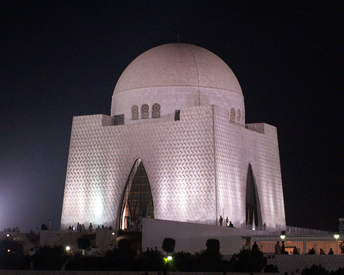
Karachi
Karachi also called as "the City which never sleeps or the city of lights Uroos ul Bilaad" and "City of the Quaid", is capital of province Sindh and capital of Pakistan until Islamabad was constructed as a capital as well as the largest and most populous metropolitan city of Pakistan covering an area of 3257 sq Km having a density of more than 6000 people per sq km making the the 2nd-largest city in the world by population within city limits, the 7th largest urban agglomeration in the world and the largest city in the Muslim world and the main seaport and financial centre of the country.
Peshawar
The Po-lu-shah of the Chinese, Pushapura of the Persians and the Peshawar of the Mughal rulers The present capital of Khyber Pukhtunkhawa was the second capital under the Kushans from 1st to 5th Century AD.
It is the oldest living city in this part of ASIA Here once stood Asia's biggest and most famous Stupa of Kanishka at Shahji ki Dheri near the walled city's Gunj Gate.
Babusar Pass
Babusar Pass or Babusar Top lies at an elevation of 4173 m. is a mountain pass at the north of the 155 km long Kaghan Valley connecting it via the Thak Nala with Chilas on the Karakoram Highway (KKH).
It is the highest point in the Kaghan Valley. Babusar Pass is at a distance of 80 km from Naran. It is on the way to the pass that the Kaghan valley's scenery becomes most dramatic.
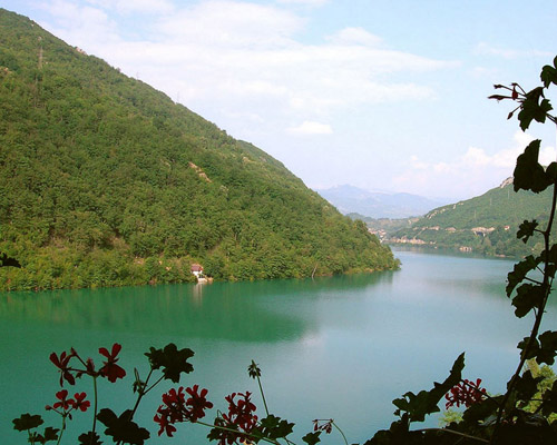
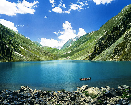
Rama
Rama valley is located in Astore approximately 112 KM from Gilgit, 56 Km from the KKH at jaglot and 134 KM from Skardu via Deosai plain. Rama Valley is thickly forested with huge pine, cedar, fir and juniper trees. The valley is about 3300 meters above sea level and thus is snow covered for 7-8 months of the year. In summer, it becomes lush green; conditions favored by local shepherds Rama is home to some famous species like: ibex, musk deer, snow leopard and rock partridge .The area is also considered to have plethora of medicinal plants. This valley offers a number of tourist attractions including: sightseeing, trekking, wild life, forest, glaciers and above all the beautiful Rama Lake which is spectacular and eye catching. Rama valley with lush green pastures and tall pine trees is an ideal camp site for the independent travelers.